
Glassboro Neighbors Around an Address
The block around a Glassboro address has several record layers, and each answers a narrower question than “who lives here.” The assessment and property searches can lead to a parcel, owner query, block, lot, and qualifier. The GIS and zoning map place that parcel within visible streets, routes, redevelopment labels, and nearby geometry. Historical surveys, newspapers, and directories add dated context. A lawful voter-list request may provide a regulated registration record, but the reviewed sources do not show a public block-wide search method.
| Glassboro block source | What it can show nearby | Access and limit |
|---|---|---|
| County assessment search | Location, owner query, block, lot, qualifier, and assessment context | Public workflow; exact historic coverage and result fields were not located. |
| Gloucester County GIS | Parcel and county map layers around the selected area | Viewer controls are JavaScript-dependent; adjacency tools were not documented in the research. |
| Glassboro zoning map | Street grid, blocks, routes, rail corridor, and redevelopment context | Planning context, not proof of ownership or occupancy. |
| GCHS surveys and newspapers | Historic adjacent properties, landmarks, names, and dated notices | Request a specific item and verify its date and page. |
| Lawful voter-list route | Registration information released under New Jersey law | Request format, fields, fee, and redactions from the Commissioner of Registration. |
Owner and occupant are different categories. A tax or deed result can establish a party’s link to a parcel. It does not identify every person who lived there, establish a current household, or turn a neighboring map shape into a legal boundary.
The Gloucester County assessment search is a useful address-to-parcel starting point for a bounded block question.
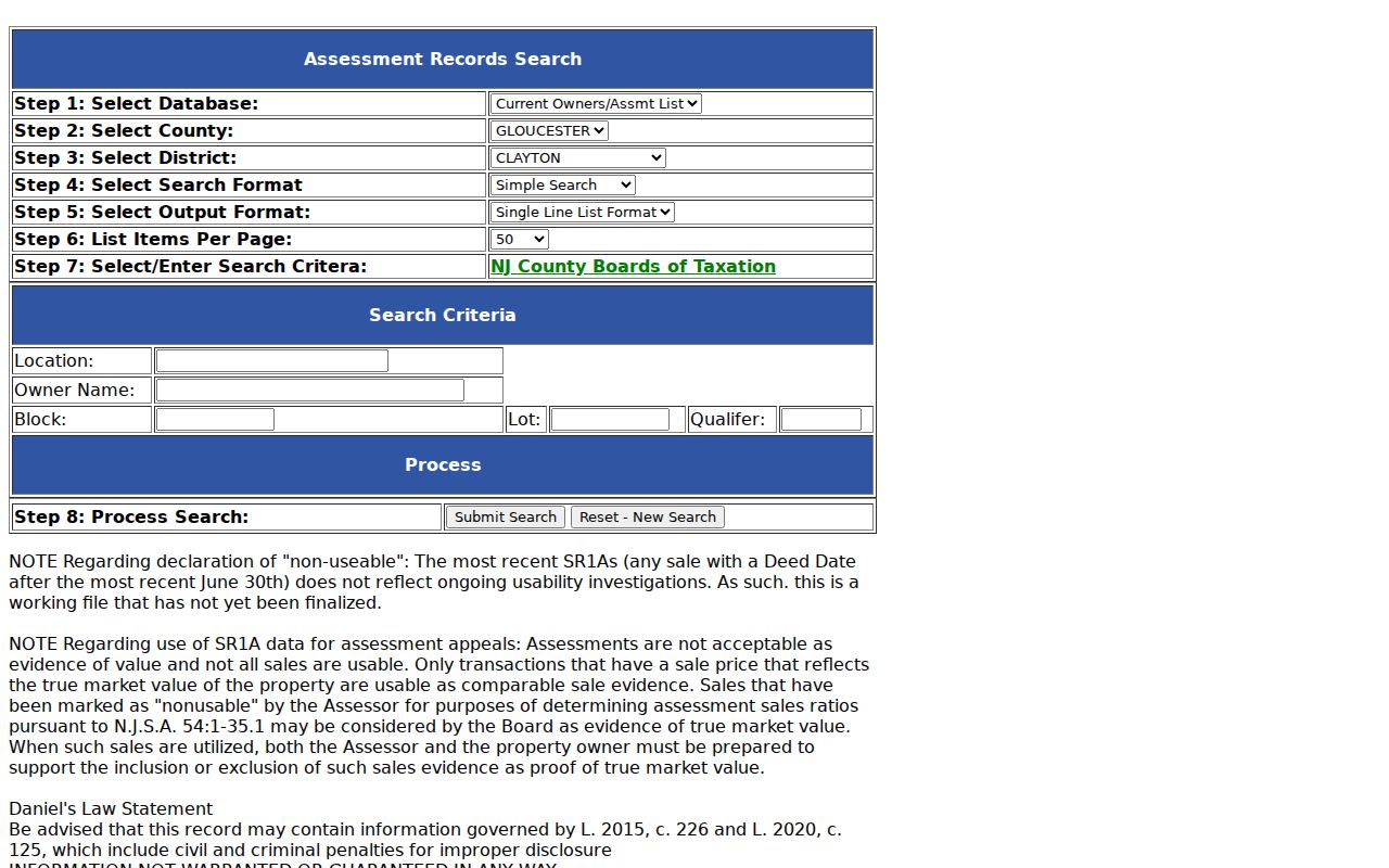
The visible workflow emphasizes location, owner name, block, lot, and qualifier. Use those fields to identify the parcel, not to infer a full set of nearby residents.
Define Glassboro Neighbors by Block
Before searching the immediate block, define the study unit in the language of the record. It can be a map block, a small parcel cluster, a street segment, a zoning or redevelopment area, or a historic landmark area. The Borough zoning map labels Downtown, East High, West High, Rowan Boulevard, Glassboro Business Park, and the Conrail or former PRSL corridor. Those labels are useful planning and geography terms, but they are not automatically formal neighborhood names or a basis for a household list.
For present parcels, start with the municipal district and the block, lot, and qualifier. For an older address, add the legal description, road or street name as printed, map sheet, and dated landmark. The 1905 six-sheet Sanborn map can describe building footprints and local context, while a current parcel layer can show a later shape. They must be read at their own dates. A building shown in 1905 is not evidence of a named neighbor in another decade.
Note: Attribute every neighborhood label to the map, borough notice, organization, or collection that actually uses it.
Map Glassboro Parcel Neighbors
The reliable adjacent-parcel method is map-browse followed by individual parcel queries. The County GIS page links to a JavaScript ArcGIS viewer, but the reviewed sources did not expose a stable click-adjacent, radius, buffer, measure, or select-tool specification. That gap matters. Do not claim that a tool produces a legal set of adjoining owners when the live method has not been documented. Instead, save the map date, visible layer names, scale, and the parcel geometries seen around the starting address.
- Locate the starting street or address in the county map context and write down the visible parcel identifier or the block, lot, and qualifier.
- Record the geometries immediately beside the selected parcel, including any map uncertainty or generalized boundaries.
- Query each nearby identifier in the county property or assessment route, keeping mailing and situs addresses separate when they appear.
- Compare a deed legal description or survey before calling two parcels legally adjacent, then retain the date of each record.
The statewide NJ Geographic Information Network parcel layer provides a second vocabulary: parcel PIN, municipality, block, lot, qualifier, class, location, street address, and update date. The state cautions that parcels are not surveys, county edges may not match, and hosted owner names may be redacted under Daniel’s Law. Those cautions apply to Glassboro block research as much as the map itself.
For a full named-street chain rather than the immediate block, use the Glassboro by-street directory, which follows address-keyed records without turning the map into a current roster.
Glassboro Maps for Micro-Areas
Glassboro’s map context can sharpen a block search without naming residents. The zoning map includes the street grid, blocks, state and county routes, the rail corridor, and redevelopment labels. The 2025 Academy Row notice identifies East High Street and South Academy Street as a downtown project location. Pair a dated notice like that with the zoning map, parcel/deed history, and older records to understand a site transition. It is not a list of occupants or a substitute for the individual property record.
Historic research gains another layer from the Library of Congress 1905 Glassboro Sanborn map. Its six sheets can show structures, industrial or institutional context, street names, and nearby landmarks. GCHS surveys can add waterways, schools, churches, and adjacent properties. A responsible account says whether a detail came from a survey, map, deed, or newspaper, and does not carry a later address backward without a dated bridge.
Glassboro’s glassmaking and railroad vocabulary, the Rowan campus, and the downtown redevelopment record are practical search terms for historical map and archive queries. They are local context, not proof that any specific person lived on the block.
Glassboro Civic Neighbor Sources
No complete official Glassboro neighborhood-association directory with current officers and boundaries was located in the research. That is an important limit. The safer community layer consists of public organizations and dated publications. Borough boards and commissions, the official business directory, local historical organizations, and Rowan collections can establish that an organization existed, met, or published a record. Membership or household connection needs an official roster or publication and should be called affiliation rather than residence.
Borough Boards and Commissions
Glassboro’s official boards page identifies Planning, Zoning, Historic Preservation, Green Team, Parks and Recreation, Creative Glassboro, and other civic bodies. Use dated agendas or minutes for an official action.
Published Local Organizations
The Borough business directory lists civic, religious, cultural, and other organizations. A listing confirms public organization presence, not an individual member’s home address.
Memory Mapping Route
The Glassboro Historical Society describes its Memory Mapping Project and meets at the West Jersey Depot on Oakwood Avenue. Its stories and images are leads to verify with deeds, maps, newspapers, or collections.
The New Jersey business-license search is another public organization source. It searches by profession, license type, business, license number, and city. A business or license result verifies a regulated credential at a date, not a personal residence or a household connection.
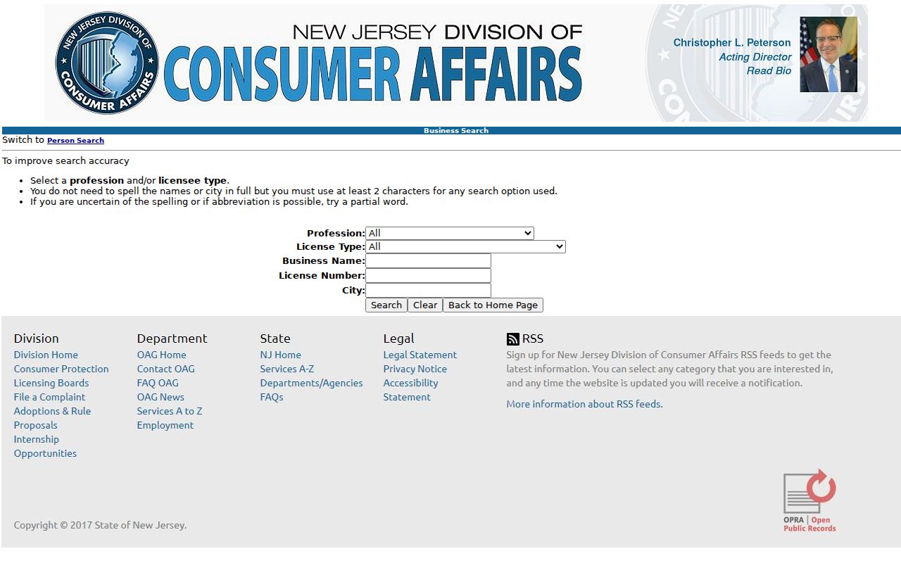
The search controls show why this source belongs in an affiliation check, not a neighbor roster: the public business route is organized around professional and business identifiers.
Historic Glassboro Neighbors by Survey
Historic neighbors are best reconstructed as a dated pattern, not as a current list. GCHS describes private surveys, maps, newspapers, family files, and Every-Name and Place indexes that can connect a place to nearby properties, waterways, schools, churches, landmarks, or a public notice. Its county historical material includes deed books, road records, tax material, railroads, election canvasser reports, and other series. Ask for the particular place-index or survey item, then retain the collection name, item, page, date, and access status.
Rowan University Archives and Special Collections adds maps, yearbooks, rosters, local publications, photographs, manuscripts, and Glassboro material. A yearbook or roster documents an institutional association at its publication date. A historical directory or newspaper is similarly time-bound. Pair either one with a parcel, deed, or map before describing an address relationship.
Note: Exact Glassboro directory runs and a public current household roster were not located in the official sources reviewed.
Glassboro Neighbor Sources Compared
Official and archival sources identify their custodian, date, and access restrictions. Commercial neighbor tools are a different category: they may combine public and purchased information, but their methods, correction process, and persistence of any opt-out vary. The research did not locate an official New Jersey one-stop opt-out directory for every commercial data broker. When accuracy matters, return to the county, borough, court, archive, or state custodian that created the record.
| Source type | Best use around a block | Limit to state plainly |
|---|---|---|
| Official parcel, deed, or map record | Identify land, a recorded party, parcel context, and date | Does not prove every occupant or current household. |
| Archive, survey, directory, or newspaper | Trace a dated historic address or community connection | Needs date and repository verification. |
| Published civic organization record | Document an organization’s public presence or affiliation | Membership is not residence without an official dated roster. |
| Commercial neighbor category | May supply a lead to test | Do not treat an aggregation as a custodian record or a complete roster. |
A source should be easy to revisit: retain its custodian, record type, date, query, and access limit. That makes a Glassboro block lead testable without pretending it is a complete or permanent household record.
Glassboro Neighbor Privacy Limits
New Jersey’s OPRA framework allows a custodian to redact sensitive data, including signatures, driver-license data, unlisted telephone numbers, protected addresses, and other exempt fields. Daniel’s Law, P.L. 2021, c.371, can leave a county index lead while restricting an image, physical book, or address for a covered person. The Address Confidentiality Program uses a lawful substitute address for eligible participants. Do not attempt to work around either protection or republish an old protected address.
The New Jersey Office of Information Privacy explains the Daniel’s Law program, while the county Clerk warns that protected records can remain visible as index entries even when images are inaccessible. A record gap can therefore be a valid restriction. Voter signatures and protected home addresses are excluded from the lawful list framework, and the research found no official block-wide public voter-search mechanics.
The OIP material documents why a Glassboro block inquiry must treat a redaction or missing address as an official result, not an obstacle to defeat.
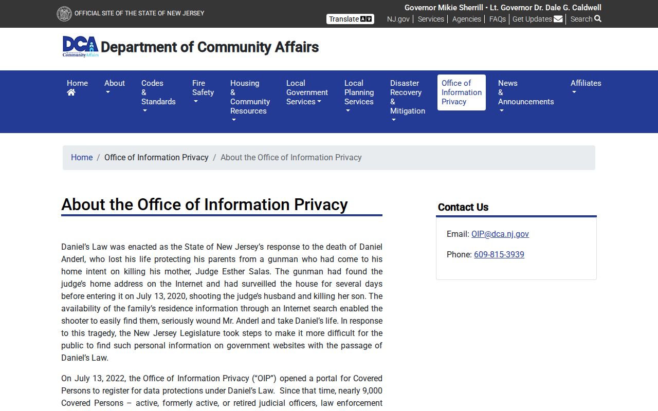
Protected-address rules apply to information from a map, index, or other public record layer. Contact the responsible custodian or program through its official route if a correction or protection issue arises.
Lawful use. Use Glassboro block records for personal research, neighborhood history, civic context, and source verification. Do not use a name, address, map, or record to watch, harass, intimidate, or harm anyone.