
Glassboro ZIP Code Postal Association
Research identified one primary postal association for Glassboro: ZIP Code 08028. The Borough's 1 South Main Street address and Rowan and GCLS addresses use 08028 on official pages. That supports the association, but it does not create a street-by-street boundary table. The official sources reviewed did not provide an authoritative USPS boundary list for every Glassboro street, a post-office service-area map, or a complete roster for a postal code.
That limited finding is important. No additional ZIP should be called a Glassboro ZIP without an authoritative USPS result for the specific address. A nearby road, school area, county service area, or municipal border can be close without sharing the same postal delivery label. Treat the postal code as a delivery aid, then verify the exact street, ZIP+4, municipality label, and any border-address condition with USPS.
| ZIP | Areas documented in research | Postal association | Verification note |
|---|---|---|---|
| 08028 | Glassboro mailing context on official borough, Rowan, and GCLS addresses | Glassboro primary association | Confirm the full delivery address, ZIP+4, and border condition with USPS. |
Note: The documented association supports postal verification, not a claimed municipal boundary or a ZIP-wide resident roster.
Glassboro Postal Directory Boundaries
A postal code follows delivery operations, while Glassboro records are often organized by municipality, district, street, block, lot, qualifier, or legal description. The county property search and assessment workflow do not expose a ZIP filter. New Jersey Geographic Information Network parcel material uses address, county, municipality, block, and lot fields rather than ZIP. The voter status portal was restricted during research, so no ZIP-search capability should be assumed there.
This is a records-geography issue, not merely a mailing detail. A postal city label can extend beyond a municipal line, and a municipal source can use an address field with a different purpose from mail delivery. A vote-by-mail form uses ZIP as part of an applicant address. An OPRA form uses city, state, and ZIP for the requestor's return information. Vital forms use city or county of event. Those fields cannot be treated as one common boundary system.
Verify Glassboro Postal Delivery by Address
A full address produces a better Glassboro postal verification than a municipality name alone. Keep the address exactly as a source printed it, then normalize the street suffix and direction in a separate note. Do not overwrite an older spelling with a modern one. Record the municipality, county, ZIP, and ZIP+4 independently whenever an official source supplies them. That record trail makes it easier to explain why two sources use different labels.
- Use the USPS postal lookup to verify the complete delivery address and postal code.
- Test the same address in the county property search to confirm its municipal and parcel context.
- Record the district, block, lot, qualifier, or parcel identifier displayed by an official source, without treating it as a postal field.
- Check the Gloucester County GIS route or NJ GIN layer for map context, then note the visible layer and access date.
- For a border or inconsistent result, ask the relevant postal or address custodian rather than selecting a ZIP from a nearby community.
USPS verification is the delivery check. County parcel sources establish property and municipal context. The two records should be retained together, not substituted for one another.
Glassboro Address Search Fields
The research did not identify a public local portal that returns people by ZIP across Glassboro. It did document the search fields that county and state tools actually use. This matters because a searcher can first validate a postal address, then move to the correct parcel or election process without claiming that those systems are ZIP directories. Exact live voter fields were not located because the official status-check portal restricted automated access.
The table separates a documented ZIP check from tools that use other location keys. It preserves the gaps instead of turning a postal code into a broad search filter that the official systems do not expose.
| Tool | Documented field or mode | ZIP result limit |
|---|---|---|
| USPS postal lookup | Complete address verification | Use for postal validation; research did not capture a field inventory. |
| County property search | District, house number, street, owner, block, lot, qualifier | No ZIP filter exposed. |
| County assessment search | Location, owner, block, lot, qualifier, plus workflow format fields | No ZIP filter exposed. |
| NJ GIN parcel layer | Address, county, municipality, block, lot, PIN and related parcel fields | No ZIP filter documented. |
| NJ voter status portal | Live labels and behavior not located in permitted research access | Do not infer ZIP-wide results. |
Glassboro Parcel Map and Postal Context
The New Jersey Geographic Information Network parcel layer gives a useful vocabulary for a postal-address check: PAMS PIN, municipality, block, lot, qualifier, county, property class, location, street address, and update fields. It is a statewide composite, not a survey. Hosted parcel and tax outputs can redact owner names under Daniel's Law, and parcels may not edge-match across counties. Use the map to organize a search and compare geometry, not to settle a legal boundary.
The New Jersey cadastral layer is the source shown below. Its field schema helps preserve a ZIP as one address component while keeping the official parcel identifiers in their own columns.
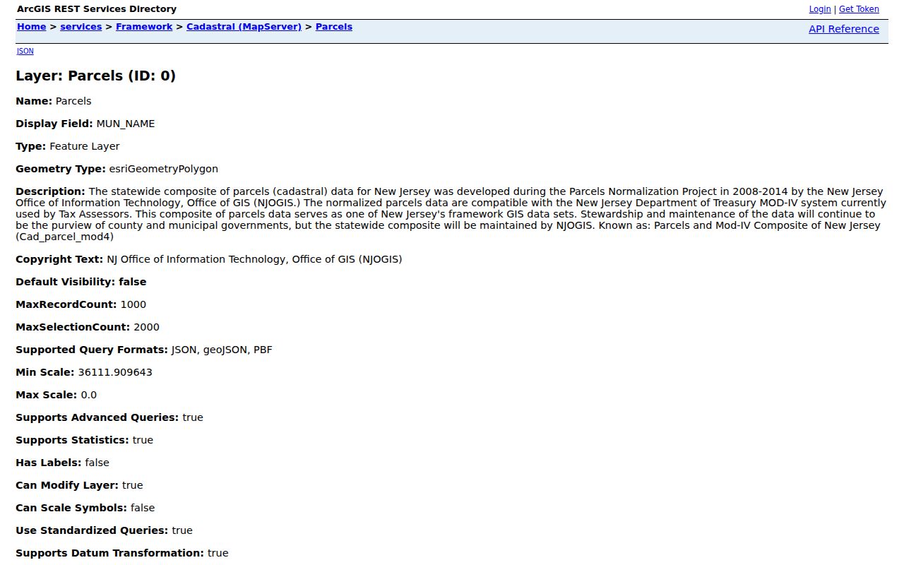
The parcel schema supports address and map comparison, but it does not publish a Glassboro ZIP-wide roster or replace a recorded survey.
Glassboro Postal and Borough Lines
No official street-level USPS boundary table, ZIP split or realignment year, local E911 addressing page, enclave inventory, or public school address finder was located in the research. That is why the Glassboro ZIP code directory does not claim that 08028 follows every borough edge. The practical verification chain is USPS for delivery, County GIS and assessor tools for parcel context, and Borough Planning and Zoning for local addressing or map questions.
Planning sources describe the local grid, block references, routes, former railroad corridor, and redevelopment areas such as Downtown, East High, West High, Rowan Boulevard, and Glassboro Business Park. They are valuable context when an address has changed around a redevelopment area. They are not postal-boundary evidence. In particular, the March 2025 Academy Row notice at East High Street and South Academy Street marks a dated planning change, not a ZIP boundary or resident list.
Glassboro Postal Fields in Election Records
New Jersey's voter record paths use address information for election administration, but the research did not document a ZIP-wide public lookup. The status-check portal should be used only through its permitted personal route. The Gloucester County Election Division can provide registration and vote-by-mail forms and can identify the current local process. A lawful voter-file request must confirm release format, fee, available fields, redactions, and use conditions with the Commissioner of Registration.
N.J.S.A. 19:31-39 governs specified voter-list production. It excludes signatures and protected home addresses, while the Government Records Council describes redaction of Social Security numbers, driver-license data, and other protected information. A ZIP on a vote-by-mail form is an address field. It is not proof of a municipal boundary or a way to infer a person's residence from a broad postal search.
Note: Preserve the difference between a mailing ZIP, a registered address, a parcel location, and an officially protected address.
Historic Glassboro Addresses Before Postal Codes
Historic Glassboro records predate postal codes, so leave the ZIP field blank when a source did not use one. Preserve the dated street string, legal description, block and lot, nearby landmark, or map sheet instead. The August 1905 six-sheet Sanborn map can establish street and structure context. Deeds, newspapers, directories, census releases, GCHS maps and surveys, and State Archives material can supply independent dated evidence. A modern ZIP should not be backfilled into an old record as if it existed then.
Older address research also requires caution with names and map labels. The official research did not find a Glassboro street-renumbering or annexation chronology, nor exact Glassboro criss-cross-directory runs. Bridge the oldest and newest legal descriptions through parcel identifiers, maps, and dated records. The Glassboro street directory has the full address-to-parcel-to-deed workflow once the postal check is complete.
Glassboro Postal Terms to Keep Separate
Postal and records terms sound similar, but they identify different things. Keeping them separate prevents a delivery label from being mistaken for a legal description or a county search key. The research supports a careful approach because it found one Glassboro association, not a complete street-boundary inventory or a ZIP-based people-search system.
- ZIP Code
- A postal delivery code that helps route mail and does not define borough, parcel, or election boundaries.
- ZIP+4
- An added postal segment used with a postal code for more precise delivery routing when officially provided.
- PO-box ZIP
- A postal code used for box delivery; no Glassboro PO-box-only ZIP was established in the research.
- Unique ZIP
- A code associated with a single organization or institution; no Glassboro unique ZIP was established in the research.
- Carrier route
- A postal delivery grouping, not a municipal district or a public resident directory.
Limits of a Glassboro Postal Directory
The responsible result for a Glassboro postal search is often a verified address and a clear statement of what the source does not show. County parcel tools may identify a location through municipal and block or lot fields. Land records can identify parties to an instrument. Planning maps can provide map context. None of these creates a complete current list of people attached to a postal code. A mailing address may also differ from a physical location.
New Jersey protected-address rules remain in force across record systems. Daniel's Law can restrict address images or books for covered people, and the Address Confidentiality Program provides a substitute address for eligible participants. Respect redactions, avoid sensitive identifiers, and ask the custodian about a particular record category. Use postal and public-record leads for lawful personal, civic, family-history, estate, or property questions only.
Lawful use. Never use a Glassboro postal code or address lead to stalk, harass, threaten, or harm another person.